Interactive Maps
Interactive Maps
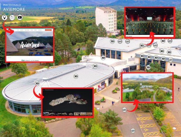
Make your venue easy to explore with our custom interactive maps. By combining 3D virtual tours and 360 photography, we create engaging, clickable maps that help guests, planners, and visitors navigate your hotel, resort, or event space with ease. Whether it’s understanding room layouts, exploring facilities, or planning an event, our interactive maps bring your venue to life online.

Interactive Map
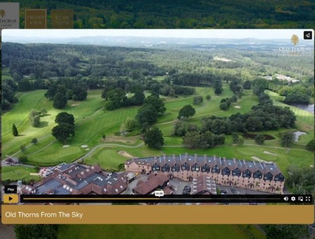
An interactive map typically starts with an aerial photo or a custom illustration of your venue, giving users a clear, top-down view of the entire site. This visual foundation helps guests and planners understand the layout at a glance. At Venue View, we can also take care of all your aerial photography need, capturing high-quality drone images that are ideal for building accurate, engaging interactive maps.
3D and 360° Content
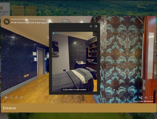
360 photos and virtual tours enhance an interactive map by turning it into a fully immersive, user-friendly experience. Instead of simply viewing a flat layout, users can click on specific areas—such as meeting rooms, suites, or outdoor spaces—to instantly open a 360-degree photo or step into a virtual tour of that exact location. It’s especially valuable for larger venues, hotels, and resorts, as it helps guests and planners visualise the flow of the space and make informed decisions.
Information Hotspots
Adding multi-media hotspots to an interactive map transforms it into a powerful visual tool. These clickable points can link to 360 photos, virtual tours, videos, or key information—giving users an instant, in-depth look at your venue. It makes the map more engaging, informative, and useful for guests, planners, and sales teams alike.
Aerial Drone Videos
Including an aerial drone video to your interactive map is a stunning way to showcase the full layout of your resort or venue in a cinematic, engaging format. It gives viewers a sweeping, bird’s-eye view that captures the scale, setting, and surroundings of your property. When combined with clickable map elements, it creates a powerful first impression and helps guests or event planners instantly understand how your spaces connect, all while experiencing your venue in a dynamic and visually impressive way.
We would love to hear from you!
Drop us a line here and we’ll get straight back to you.
